Old Ordnance Survey Maps of Worcestershire

  • These detailed maps normally cover an area of about one and a half miles by one mile. Each map includes an introduction.
  • They are available through our On-line Mapshop

  • Here are the details of maps for Bromsgrove:

  • Worcestershire Sheet 15.16 Bromsgrove 1926 - published 2004; intro by Malcolm Nixon. ISBN.978-1-84151-650-9

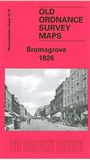
    This detailed map covers most of the town of Bromsgrove, which stretches along the Worcester-Birmingham Road. Coverage stretches from Highfield Road northward to the Churchfields area.

    Features include Bromsgrove School, St John the Baptist church, Cemetery, Fordhouse Farm, Warwick Hall, Moat Mill (disused), St Peter's RC Chapel, Watt Close School, button manufactory, Bromsgrove Guild, Stoney Hill area, Churchfields area, Blackmore Mill, Hill Top area, Whitford Hall, Whitford Mill, etc. Note the map does NOT include the railway. On the reverse we include the commercial entries from a 1896 directory.


  • You can order maps direct from our On-line Mapshop. For other information, a full catalogue and Prices, see Index Page.
  • Maps in the Godfrey Edition are taken from the 25 inch to the mile map and reduced to about 15 inches to the mile. For a full list of maps for the area, return to the Worcestershire page or West Midlands page.
    The Godfrey Edition / sales@alangodfreymaps.co.uk / 7 November 2016