
 Here are the details of maps for Whitchurch:

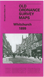
This detailed map of the north Shropshire town of Whitchurch is double-sided to give maximum coverage. The main map covers the centre of the town and extends westward to the area called Chemistry and southward to Moss Villa and Mossfield almost a mile out of town. Features include the town centre, High Street, Watergate, Smithfield, church, Market Hall, Jubilee Park, Shropshire Union Canal, Gas Works. On the reverse we include a section of adjacent sheet 8.01 which extends coverage eastward to include the important station, including engine shed and junction with the Cambrian line. A directory of Whitchurch in 1905 is also included.
You might find this index map useful.