Old Ordnance Survey Maps of Much Wenlock


We have published more than 1,800 maps in our series of Old Ordnance Survey Map reprints, including a good groups for Shropshire. The maps are highly detailed. They are taken from the OS 1:2,500 (or 25 inch) maps and reduced to about 15 inches to the mile. Each covers an area of a mile and a half by a mile. They show streets with individual houses, tram tracks, railway tracks and even signals, factories, wharves and such details as fountains and water troughs. They will provide hours of fascination for historians and genealogists. The maps are neatly folded and each includes a specially written introduction to the area. Maps can be purchased on our On-line Mapshop where further information about titles is given. Or visit The Index Page for a full list to the series and details of Prices.


Here are the details of maps for Much Wenlock:

  • Shropshire Sheet 50.08 Much Wenlock 1925 - published Nov 2005; introduction by Barrie Trinder

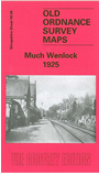
    This detailed map covers the little town of Much Wenlock, until the 1960s the largest (in area) non-county borough in England, and home in the mid 19th century to the Wenlock Olympian Society. Barrie Trinder tells us all about that in his notes. The sheetlines are awkward and so the map is double-sided to provide good coverage. The main map covers the northern part of the town, coverage extending northward to Shadwell Rock quarry, Downs Mill and Forester Cottage Hospital. Features include the station on the GWR branch, St Milburga's Priory, High Street, Holy Trinity church. On the reverse we include much of adjacent sheet 50.12 to extend coverage southward, and features here include the south of the town, race course, The Bank, The Causeway.


    Follow this link for a complete list of our Shropshire Series maps.

    You can order maps direct from our On-line Mapshop. For other information and prices, and other areas, go to The Index Page.


    Maps in the Godfrey Edition are taken from the 25 inch to the mile map and reduced to about 15 inches to the mile. For a full list of maps for the Shropshire area, return to the West Midlands page.

    The Godfrey Edition / godfreyedition@btinternet.com / 24 November 2005