Old Ordnance Survey Maps of Shropshire

  • These detailed maps normally cover an area of about one and a half miles by one mile. Each map includes an introduction.
  • They are available through our On-line Mapshop

  • Here are the details of maps for Wem:

  • Shropshire Sheet 21.03 Wem 1924 - published 2004; intro by Derrick Pratt. ISBN.978-1-847151-612-7

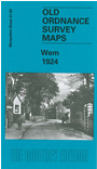
    This detailed map of the small north Shropshire town of Wem is double-sided to give maximum coverage. The main map covers the centre of the town and extends southward to Tilley. Features include the High Street, River Roden, railway with station (at the top of the map), Wem Mill, cattle market, church, Drawwell Brewery, Tilley House, site of castle. On the reverse we include a large extract from adjacent sheet 14.15 and this extends coverage northward about a mile; features here include Shrubbery Gardens, The Hall, Poor Law Institution, cemetery, Creamore Mill, Creamore Bank. We also include extracts from a directory of Wem in 1905.


  • Follow this link for a complete list of our Shropshire or Telford maps.
  • You can order maps direct from our On-line Mapshop. For other information and prices, and other areas, go to The Index Page.
  • Maps in the Godfrey Edition are taken from the 25 inch to the mile map and reduced to about 15 inches to the mile. For a full list of maps for England, return to the England page.
    The Godfrey Edition / sales@alangodfreymaps.co.uk / 30 January 2018