We have published more than 2,100 maps in our series of Old Ordnance Survey Map reprints, including a growing title range in East Anglia. The maps are highly detailed. They are taken from the OS 1:2,500 (or 25 inch) maps and reduced to about 15 inches to the mile. Each covers an area of a mile and a half by a mile. They show streets with individual houses, tram tracks, railway tracks and even signals, factories, wharves and such details as fountains and water troughs. They will provide hours of fascination for historians and genealogists. The maps are neatly folded and each includes a specially written introduction to the area. Maps can be purchased on our On-line Mapshop. Or visit The Index Page for a full list to the series and details of Prices.
Here are the details of maps for Newmarket
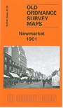
This detailed map provides good coverage of the town of Newmarket, which is split between Suffolk and Cambridgeshire. Most of the actual town is covered, with coverage extending northward to Warren Hill station, westward to Scaltback Farm. Features include the station, High Street with all buildings neatly delineated, St Mary's Square, Jockey Club Rooms, All Saints church, St Mary's church, Cattle Market, Lincoln Lodge, Phantom House, Warren House, Newmarket Mills, Workhouse, St Etheldreda's church, The Severals, Tan Gallop, Rous Memorial Hospital, Severals House and other villas, Tattersall's Sale Paddock etc. A list of private residents from a 1912 directory is included on the reverse.
Follow this link for a complete list of our Suffolk Series maps.
You can order maps direct from our On-line Mapshop. For other information and prices, and other areas, go to The Index Page.
Maps in the Godfrey Edition are taken from the 25 inch to the mile map and reduced to about 15 inches to the mile. For a full list of maps for East Anglia, return to the East Anglia page.
The Godfrey Edition / godfreyedition@btinternet.com / 17 April 2008