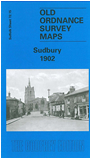
Suffolk Sheet 72.15 Sudbury - published 2000; introduction by Robert Malster. ISBN 978-1-84151-203-7 
This detailed map provides good coverage of centre and north of Sudbury. Coverage stretches from Stour Street and Gainsborough Street northward
to Arthur Hall and Bartholomew Farm. Features include railway (but not station), St Peter's church, Market Hill, Freemen's Great Common, workhouse,
Great and Little Fullingpit Meadows, Acton Square, silk manufactories, malthouse, North Street, Brundon, Brundon Mill. We include a directory of Sudbury in 1896.
Follow this link for a complete list of our Suffolk Series maps.
You can order maps direct from our On-line Mapshop.
For other information and prices, and other areas, go to The Index Page.
Maps in the Godfrey Edition are taken from the 25 inch to the mile map and reduced to about 15 inches to the mile.
For a full list of maps for East Anglia, return to the East Anglia page.
The Godfrey Edition / sales@alangodfreymaps.co.uk / 24 November 2017

 Here are the details of maps for Sudbury: