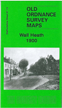
 Here are the details of maps for Wall Heath:

This detailed map covers the village of Wall Heath, in Kingswinford parish. Coverage stretches from Holbeche House southward to Ashwood House and Dawley Brook, and from Hinksford Farm, eastward to Stalling's Farm and Himley Colliery. The area is best known for Holbeche or Holbeach House, where the Gunpowder Plot particpants were arrested. Other features include mineral railway with sidings into sand pits, Wall Heath Forge, Dawleybrook Wharf, Heathbrook arm, Himley Colliery Pits 7 and 8, Elmtree House etc. On the reverse we include a directory of Kingswinford and Wall Heath.
The map links up with sheets 67.14 Shut End to the east and 71.01 Kingswinford to the south.