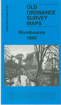
Staffordshire Sheet 67.05 Wombourne 1900 - published 2000; intro by Angus Dunphy. ISBN.978-1-84151-137-5 
This detailed map covers a largely rural area SW of Wolverhampton, of which the main feature is the village of Wombourne.
Features include St Benedict's church, Old Bush Inn, Duneden, Greenhill House, Rushford Slang, The Wodehouse, The Foxhills,, Woody Park. On the reverse we include a portion of adjacent sheet 67.09
extending coverage south to include Himley Hall. A directory of Wombourne is also included.
The map links up with Staffordshire sheets 67.06 Sedgley West to the east.
For a full list of maps of Staffordshire county, please go to the Staffordshire page or the
Potteries page.
You can order maps direct from our On-line Mapshop.
For other information and prices, and other areas, go to The Index Page.
Maps in the Godfrey Edition are taken from the 25 inch to the mile map and reduced to about 15 inches to the mile.
For a full list of maps for England, return to the England page.
Alan Godfrey Maps, Prospect Business Park, Leadgate, Consett, Co Durham, DH8 7PW /
sales@alangodfreymaps.co.uk / 28 January 2018

 Here are the details of maps for Wombourne: