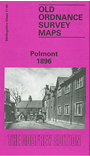
Stirlingshire Sheet 31.05 Polmont 1896 - published 1992, intro by Ian Scott. ISBN.978-0-85054-630-0 
This detailed map of Polmont is double-sided for maximum coverage. The main map covers most of the village, with coverage extending southward to Pomont station and Brightons, and westward to Redding. Features include railway with station,
Millfield, Polmont House, St Margaret's School, Parkhill, Union Canal, Blair Lodge, Redding, hospital etc.
On the reverse we include part of adjacent sheet 31.01 extending coverage northward to include Beancross, route of Antonine Wall, Inchyra Grange, Little Kerse, church.
Follow this link for a list of our maps for Stirlingshire or here for a general list for Scotland.
You can order maps direct from our On-line Mapshop.
For other information and prices, and other areas, go to The Index Page.
Maps in the Godfrey Edition are taken from the 25 inch to the mile map and reduced to about 15 inches to the mile.
For a full list of maps for England, return to the England page.
Alan Godfrey Maps, Prospect Business Park, Leadgate, Consett, Co Durham, DH8 7PW / sales@alangodfreymaps.co.uk / 21 November 2016

 Here are the details of the map for Polmont: