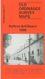
Stirlingshire Sheet 15.13 Balfron & Killearn 1896 - published 1991; intro by Jim Thomson. ISBN.978-0-85054-475-6 
This detailed map is double-sided for maximum coverage. The main map covers most of the village of Balfron with the area to the north, northward to Cairnhall. Features include
The Clachan, churches etc.
On the reverse we include a small portion of adjacent sheet 21.01 covering the southern part of the village, including Mains of Branshogle, Ballindalloch Mill, Endrick Bridge, Ballindalloch. We also include
a map of the village of Killearn, showing Blacklands, Kirkhouse, Spittal, and village centre.
Follow this link for a list of our maps for Stirlingshire or here for a general list for Scotland.
You can order maps direct from our On-line Mapshop.
For other information and prices, and other areas, go to The Index Page.
Maps in the Godfrey Edition are taken from the 25 inch to the mile map and reduced to about 15 inches to the mile.
For a full list of maps for England, return to the England page.
Alan Godfrey Maps, Prospect Business Park, Leadgate, Consett, Co Durham, DH8 7PW / sales@alangodfreymaps.co.uk / 21 November 2016

 Here are the details of the map for Balfron: