Old Ordnance Survey Maps of Stirlingshire

  • These detailed maps normally cover an area of about one and a half miles by one mile. Each map includes an introduction.
  • They are available through our On-line Mapshop

  • Here are the details of maps for Bridge of Allan:

  • Stirlingshire Sheet 10.07 Bridge of Allan 1896 - published 1989. ISBN.978-0-85054-258-5

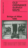
    This detailed map of Bridge of Allan is double-sided for maximum coverage. The main map covers the north of the village, with coverage stretching from the Bridge of Allan itself northward to Sunnylaw. Features include railway with station, Airthrey Mills, Allan Water, Westerton, Hydropathic Establishment, Well House, Mine Wood, old quarries, Hill of Airthrey etc.

    On the reverse we include most of adjacent sheet 10.11, extending coverage southward to include, Keirfield Mill, Macfarlane Museum, Airthrey Kerse, Cornton Brick Works, Cornton Vale (at foot of map). A short introduction by Kenneth J Gray is included on the back cover.

    The map links up with sheet 10.15 Stiorling North to the south.


  • Follow this link for a list of our maps for Stirlingshire or here for a general list for Scotland.
  • You can order maps direct from our On-line Mapshop. For other information and prices, and other areas, go to The Index Page.
  • Maps in the Godfrey Edition are taken from the 25 inch to the mile map and reduced to about 15 inches to the mile. For a full list of maps for England, return to the England page.
    Alan Godfrey Maps, Prospect Business Park, Leadgate, Consett, Co Durham, DH8 7PW / sales@alangodfreymaps.co.uk / 21 November 2016