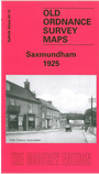
Suffolk Sheet 50.13 Saxmundham 1925 - published 2004; introduction by Robert Malster. ISBN 978-1-84151-633-2 
This detailed map provides good coverage of the small town of Saxmundham, with coverage continuing eastward a mile into open country, as
far as Wardspring Farm. Features on the map include station, Market Place, High Street, South Entrance, church, Hurts Hall, Auction Mart. We
include an 1896 directory of Saxmundham on the reverse, together with a 1915 timetable for the Ipswich-Yarmouth line and Saxmundham-Aldeburgh branch.
Follow this link for a complete list of our Suffolk Series maps.
You can order maps direct from our On-line Mapshop.
For other information and prices, and other areas, go to The Index Page.
Maps in the Godfrey Edition are taken from the 25 inch to the mile map and reduced to about 15 inches to the mile.
For a full list of maps for East Anglia, return to the East Anglia page.
The Godfrey Edition / sales@alangodfreymaps.co.uk / 24 November 2017

 Here are the details of maps for Saxmundham: