Old Ordnance Survey Maps of Shropshire

  • These detailed maps normally cover an area of about one and a half miles by one mile. Each map includes an introduction.
  • They are available through our On-line Mapshop

  • Here are the details of maps for Newport:

  • Shropshire Sheet 31.05 Newport 1900 - published 2012; intro by Derrick Pratt. ISBN.978-1-84784-561-0

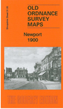
    This detailed map is double-sided for maximum coverage.

    The principal map covers the centre and northern part of the town, with coverage stretching from the High Street northward to Islington and Meretown House, and from Bromfield Place eastward to Broom Hill. Features include town centre with individual buildings neatly shown, St Nicholas church, St Mary's Iron Works, Smithfield, Shropshire Union Canal, Chetwynd End, malthouse, tannery etc.

    On the reverse we include part of adjacent sheet 31.09 extending coverage southward to include railway station, Workhouse, cemetery,, Upper Bar and Station Road area.


  • Follow this link for a complete list of our Shropshire or Telford maps.
  • You can order maps direct from our On-line Mapshop. For other information and prices, and other areas, go to The Index Page.
  • Maps in the Godfrey Edition are taken from the 25 inch to the mile map and reduced to about 15 inches to the mile. For a full list of maps for England, return to the England page.
    The Godfrey Edition / sales@alangodfreymaps.co.uk / 30 January 2018