
 Here is information about Sheet 336:
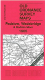
This Inch to the Mile map covers an area of Cornwall stretching from Padstow eastward to St Neot, and from Cardinham northward to Camelford. Part of Bodmin Moor is included, and features include the LSWR North Cornwall line and Bodmin & Wadebridge line. On the reverse we include a detailed map of Padstow, showing the town centre and harbour, and this map also includes the little village of Rock.
It is not possible to list the many hamlets, farmsteads and other topographical features shown on these maps. However, you may find it useful if we list the towns and principal villages or church parishes that are included on this map. Links are given for those for which detailed large-scale maps are also available.
Index maps are available showing the areas covered by the Inch to the Mile maps. Go to This page
You can order maps direct from our On-line Mapshop. For a full list of Inch to the Mile maps go to the Inch to the Mile page, where you will also find details of prices. For information on the rest of the series, go to The Index Page.