Old Ordnance Survey Inch to the Mile Maps

  • These maps normally cover an area of about 18 miles by 12 miles and are especially good at showing railways, roads and canals, and at giving a broad view of a wider area. Each includes an introduction and a more detailed map of a small town or village. They are available through our On-line Mapshop

  • Here is information about Sheet 253:

  • One Inch Sheet 253 Vale of White Horse 1893 - published 2002; intro by Tony Higgott. ISBN.978-1-84151-470-3

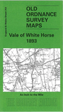
    This Inch to the Mile map, centred on Wantage, covers much of northern Berkshire. Coverage stretches from Shrivenham eastward to Didcot, and from Hinton Waldrist southward to East Ilsley. The Lambourn Downs are at the foot of the map, and the Downs run along the southern area. The GWR main line, the River Ock and the Wilts & Berks Canal run through the vale in the centre of the map. On the reverese we include an extract from Berkshire Sheet 6.08 showing the small town of Faringdon in 1910; this map is detailed, showing the station, Market Place, All Saints church, Faringdon House, Westbrook.


    It is not possible to list the many hamlets, farmsteads and other topographical features shown on these maps. However, you may find it useful if we list the towns and principal villages or church parishes that are included on this map. Links are given for those for which detailed large-scale maps are also available.

  • Berkshire: Abingdon, Appleford, Ardington, Ashbury, Balking, Buckland, Charlton, Charney Basset, Childrey, Chilton, Compton Beauchamp, Denchworth, Didcot, Draycot Moor, Drayton, East Challow, East Hagbourne, East Hanney, East Hendred, East Ilsley, East Lockinge, Eaton Hastings, Faringdon, Farnborough, Fawley, Fernham, Fritford, Fyfield, Garford, Goosey, Great Coxwell, Grove, Harwell, Hatford, Hinton Waldrist, Kingston Bagpuze, Kingston Lisle, Letcombe Basset, Letcombe Regis, Little Coxwell, Longcot, Longworth, Lyford, Marcham, Milton, Pusey, Shellingford, Shrivenham, Sparsholt, Stanford in the Vale, Steventon, Sutton Courtenay, Sutton Wick, Tubney, Uffington, Upton, Wantage, Watchfield, West Hagbourne, West Hanney, West Hendred, West Ilsley, West Lockinge, Woolstone.
  • Oxfordshire: Culham, Kelmscot, Radcot.
  • Wiltshire: Bishopstone.

    Index maps are available showing the areas covered by the Inch to the Mile maps. Go to This page


    You can order maps direct from our On-line Mapshop. For a full list of Inch to the Mile maps go to the Inch to the Mile page, where you will also find details of prices. For information on the rest of the series, go to The Index Page.


    Alan Godfrey Maps, Prospect Business Park, Leadgate, Consett, Co Durham, DH8 7PW / sales@alangodfreymaps.co.uk / 16 April 2011