Old Ordnance Survey One-Inch Maps


These maps are taken from the famous OS "Inch to the Mile" Maps. Though obviously far less detailed than the large scale maps for which we are perhaps better known, they provide an invaluable overview of a wider area, typically 18 miles across by 12 miles down. For transport historians they are invaluable for showing old railways, while all historians need them for their close depiction of topography, including parish boundaries. These maps also mean that we can offer historical coverage for small villages where a large scale map would not be commercially viable. We intend to publish the whole of England and Wales in this series. Almost 200 titles are now available and we aim to publish three new titles each month. The maps include historical notes and almost all also include a large scale map of a small town or village in the area.

The maps are neatly folded and each includes a specially written introduction to the area. Maps can be purchased on our On-line Mapshop where further information about titles is given. Visit the One Inch Page for a full list of Inch to the Mile Maps, or The Index Page for a full list to the series and details of Prices.

Here is information about Sheet 203:

  • One Inch Sheet 203a Bedford & District 1895 - published 2007; introduction Barrie Trinder - Coloured Edition.
  • One Inch Sheet 203b Bedford & District 1895 - published 2001; introduction Barry Stephenson

    We have published two versions of this map, one taken from the Coloured Edition, one black and white, but both are from the same revision.

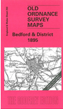
    This Inch to the Mile map, centred on Bedford, is split between Bedfordshire and Buckinghamshire, with a small area of Northants in the NW corner. Coverage stretches from Stoke Goldington and Bradwell eastward to Cardington, and from Harrold southward to Ampthill Park (though Ampthill town is beyond the map). In the SW corner is the area now covered by much of Milton Keynes, but in 1895 Bedford and Newport Pagnell were the only towns on the map. Railways include the Bedford & Northampton line and the Newport Pagnell branch. On the reverse of the Coloured Edition (203a) we include a detailed map of Milton Keynes village in 1898; the uncoloured version (203b) we include an extract from Bedfordshire Sheet 10.07, showing Turvey and Cold Brayfield in detail.


    It is not possible to list the many hamlets, farmsteads and other topographical features shown on these maps. However, you may find it useful if we list the towns and principal villages or church parishes that are included on this map. Links are given for those for which detailed large-scale maps are also available.

  • Bedfordshire: Bedford, Biddenham, Bromham, Cardington, Carlton, Chellington, Clapham, Cranfield, Goldington, Hardmead, Harrold, Haynes, Kempston, Lidlington, Millbrook, Milton Ernest, Oakley, Pavenham, Ravensden, Salford, Stagsden, Stevington, Turvey, Willshamstead, Wilden, Wootton.
  • Buckinghamshire: Bradwell, Broughton, Chicheley, Clifton Reynes, Cold Brayfield, Emberton, Filgrave, Gayhurst, Great Linford, Great Woolstone, Haversham, Lathbury, Lavendon, Little Linford, Little Woolstone, Milton Keynes, Moulsoe, New Bradwell, Newport Pagnell, Newton Blossomville, North Crawley, Olney, Ravenstone, Sherington, Stantonbury, Stoke Goldington, Tyringham, Warrington, Weston Underwood, Willen.
  • Northamptonshire: Yardley Hastings.

    For a full list of maps for the counties go to the Buckinghamshire or Bedfordshire pages.

    You can order maps direct from our On-line Mapshop. For other information and prices, and other areas, go to The Index Page.


    The Godfrey Edition / godfreyedition@btinternet.com / 13 December 2007