
Old Ordnance Survey Inch to the Mile Maps
These maps normally cover an area of about 18 miles by 12 miles and are especially good at showing railways, roads and canals, and at giving
a broad view of a wider area. Each includes an introduction and a more detailed map of a small town or village.
They are available through our On-line Mapshop
 Here is information about Sheet 189:
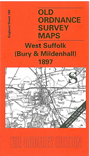
One Inch Sheet 189 West Suffolk (Bury & Mildenhall) 1897 - published 2000; intro by Robert Malster. ISBN.978-1-84151-182-5
This One Inch to the Mile map covers a western area of Suffolk, with coverage stretching from Moulton eastward to Woolpit, and from Honington southward to Bradfield St Clare. Bury St
Edmunds is near the centre of the map, with now closed railways running north and south. The only other town is Mildenhall, in the NW corner; as with other East Anglian maps, there are large numbers of
small parishes. On the back we include a section of Suffolk Sheet 33.07 and this shows the villages of Ampton and Ingham in detail, complete with directories.
It is not possible to list the many hamlets, farmsteads and other topographical features shown on these maps. However, you might find it useful if we here list the majority of the principal villages
and church parishes that are included on this map. Links are given for those for which detailed large-scale maps are also available.
Cambridgeshire: Ashley, Kennett.
Suffolk: Ampton, Bardwell, Barrow, Barton Mills, Beyton, Bradfield Combust, Bradfield St Clare, Bradfield St George, Bury St Edmunds, Cavenham, Chedburgh, Chevington, Culford, Dalham,
Denham, Drinkstone, Felsham, Flempton, Fornham All Saints, Fornham St Martin, Gazeley, Gedding, Great Barton, Great Livermere, Great Saxham, Great Welnetham, Hargrave, Hawstead, Hengrave, Herringswell, Hessett, Honington, Horningsheath or Horringer,
Hunston, Icklingham, Ingham, Ixworth, Ixworth Thorpe, Kentford, Lackford, Langham, Lidgate, Little Saxham, Little Welnetham, Mildenhall, Moulton, Newton, Norton, Ousden, Pakenham, Rattlesden, Risby, Rusbrooke,
Sapiston, Stanton, Stowlangtoft, Thurston, Timworth, Tostock, Troston, Tuddenham, West Stow, Westley, Whepstead, Woolpit, Wordwell.
Index maps are available showing the areas covered by the Inch to the Mile maps. Go to This page
You can order maps direct from our On-line Mapshop. For a full list of Inch to the Mile maps go to the Inch to the Mile page,
where you will also find details of prices. For information on the rest of the series, go to The Index Page.
Alan Godfrey Maps, Prospect Business Park, Leadgate, Consett, Co Durham, DH8 7PW / sales@alangodfreymaps.co.uk / 16 April 2011