Old Ordnance Survey One-Inch Maps


These maps are taken from the famous OS "Inch to the Mile" Maps. Though obviously far less detailed than the large scale maps for which we are perhaps better known, they provide an invaluable overview of a wider area, typically 18 miles across by 12 miles down. For transport historians they are invaluable for showing old railways, while all historians need them for their close depiction of topography, including parish boundaries. These maps also mean that we can offer historical coverage for small villages where a large scale map would not be commercially viable. We intend to publish the whole of England and Wales in this series. Almost 200 titles are now available and we aim to publish three new titles each month. The maps include historical notes and all (except the double-sided Tyneside title) also include a large scale map of a small town or village in the area.

The maps are neatly folded and each includes a specially written introduction to the area. Maps can be purchased on our On-line Mapshop where further information about titles is given. Visit the One Inch Page for a full list of Inch to the Mile Maps, or The Index Page for a full list to the series and details of Prices.

Here is information about Sheet 188:

  • One Inch Sheet 188 Cambridge, Newmarket & District 1905 - published 2000; introduction by Oliver Rackham

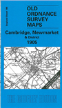
    This One Inch to the Mile map covers Cambridge and the area to the north. Cambridge itself is at the foot of the map and coverage extends northward to Wilburton and Soham, and from Oakington eastward to Cheveley and Worlington. Much of the area is fenland and features include many windmills, the Cambridge & Mildenhall railway, race courses at Newmarket. On the reverse we include an extract from Cambridgeshire Sheet 40.04 showing Waterbeach in detail, complete with directory.


    It is not possible to list the many hamlets, farmsteads and other topographical features shown on these maps. However, you might find it useful if we here list the majority of the principal villages and church parishes that are included on this map. Links are given for those for which detailed large-scale maps are also available.

  • Cambridgeshire: Bottisham, Burwell, Cambridge, Chesterton, Cheveley, Chippenham, Coton, Cottenham, Dullingham, Fen Ditton, Fordham, Girton, Great Wilbraham, Haddenham, Histon, Horningsea, Impington, Isleham, Landbeach, Landwade, Little Wilbraham, Lode, Milton, Oakington, Rampton, Snailwell, Soham, Stetchworth, Stow cum Quy, Stretham, Swaffham Bulbeck, Swaffham Prior, Teversham, Waterbeach, Westwick, Wicken, Wilburton, Woodditton.
  • Suffolk: Exning, Newmarket, Treckenham, Worlington.

    For a full list of Inch to the Mile maps go to the One Inch Page, or for a full list of local maps go to Cambridgeshire or Suffolk pages. For other information and prices, and other areas, go to The Index Page.


    The Godfrey Edition / godfreyedition@btinternet.com / 17 April 2008