Old Ordnance Survey One-Inch Maps


These maps are taken from the famous OS "Inch to the Mile" Maps. Though obviously far less detailed than the large scale maps for which we are perhaps better known, they provide an invaluable overview of a wider area, typically 18 miles across by 12 miles down. For transport historians they are invaluable for showing old railways, while all historians need them for their close depiction of topography, including parish boundaries. These maps also mean that we can offer historical coverage for small villages where a large scale map would not be commercially viable. We intend to publish the whole of England and Wales in this series. Almost 200 titles are now available and we aim to publish three new titles each month. The maps include historical notes and all (except the double-sided Tyneside title) also include a large scale map of a small town or village in the area.

The maps are neatly folded and each includes a specially written introduction to the area. Maps can be purchased on our On-line Mapshop where further information about titles is given. Visit the One Inch Page for a full list of Inch to the Mile Maps, or The Index Page for a full list to the series and details of Prices.

Here is information about Sheet 185:

  • One Inch Sheet 185 Central Northants 1906 - published 2005; introduction by Barrie Trinder

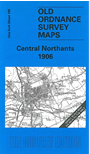
    This One Inch to the Mile map covers a central area of Northamptonshire. Coverage stretches from Staverton and Braunston eastward to Sywell and Great Billing, and from Cold Ashby and Maidwell southward to Nether Heyford. Northampton itself is near the foot of the map, and the only other town shown is Daventry. The traditional end of southern England - Watford Gap - is on the map, which is today famously traversed by the M1. The Grand Junction Canal runs through the map and railways include several now closed around Northampton, and the Weedon & Leamington, and Northampton & Market Harborough lines. Other features include Althorp Park, Overstone Park and Norton Park. On the back we include an extract from Northants Sheet 43.12 and this covers the village of Weedon Beck in more detail; it includes Road Weedon and also the barracks and large Ordnance depot on its branch canal.


    It is not possible to list the many hamlets, farmsteads and other topographical features shown on these maps. However, you may find it useful if we list the towns and principal villages or church parishes that are included on this map. Links are given for those for which detailed large-scale maps are also available.

  • Northamptonshire: Abington, Althorp, Ashby St Ledgers, Badby, Barby, Boughton, Brafield on the Green, Braunston, Brixworth, Brockhall, Chapel Brampton, Church Brampton, Claycoton, Cold Ashby, Cottesbrook, Crick, Dallington, Daventry, Dodford, Draughton, Duston, East Haddon, Far Cotton, Flaxton, Floore, Great Billing,m Great Creaton, Great Houghton, Guilsborough, Hanging Houghton, Hannington, Harlestone, Harpole, Holcot, Hollenby, Hollowell, Kilsby, Kingsthorpe, Kislingbury, Lamport, Lilbourne, Little Billing, Little Houghton, Long Buckby, Maidwell, Moutlon, Lower Heyford, Newnham, Northampton, Norton, Old, Overstone, Pitsford, Ravensthorpe, Scaldwell, Spratton, Staverton, Sywell, Teeton, Thornby, Upper Heyford, Walgrave, Watford, Weedon Beck, Welton, West Haddon, Weston Favell, Whitton, Yelvertoft.

    For a full list of maps for the county go to the Northamptonshire page.

    You can order maps direct from our On-line Mapshop. For other information and prices, and other areas, go to The Index Page.


    The Godfrey Edition / godfreyedition@btinternet.com / 21 January 2006