
 Here is information about Sheet 179:
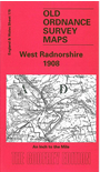
This Inch to the Mile map covers much of west Radnorshire, now part of Powys. The Cambrian Mountains dominate the western half of the map, a plateau dissected by Afon Elan and Afon Claerwen. Rhayader is in the centre of the map, and just SW of it is Elan Village, established for the builders of the Elan reservoir. The map includes the railway built for this construction work; it joins the Cambrian's Mid Wales line, which runs through the map. By contrast the handsome Victorian spa town of Llandrindod Wells is in the SE corner of the map. On the reverse we include a large scale map of Abbey-Cwmhir, together with a directory.
It is not possible to list the many hamlets, farmsteads and other topographical features shown on these maps. However, you may find it useful if we list the towns and principal villages or church parishes that are included on this map. Links are given for those for which detailed large-scale maps are also available.
Index maps are available showing the areas covered by the Inch to the Mile maps. Go to This page
You can order maps direct from our On-line Mapshop. For a full list of Inch to the Mile maps go to the Inch to the Mile page, where you will also find details of prices. For information on the rest of the series, go to The Index Page.