Old Ordnance Survey One-Inch Maps


These maps are taken from the famous OS "Inch to the Mile" Maps. Though obviously far less detailed than the large scale maps for which we are perhaps better known, they provide an invaluable overview of a wider area, typically 18 miles across by 12 miles down. For transport historians they are invaluable for showing old railways, while all historians need them for their close depiction of topography, including parish boundaries. These maps also mean that we can offer historical coverage for small villages where a large scale map would not be commercially viable. We intend to publish the whole of England and Wales in this series. Over 200 titles are now available and we aim to publish three new titles each month. The maps include historical notes and all (except the double-sided Tyneside title) also include a large scale map of a small town or village in the area.

The maps are neatly folded and each includes a specially written introduction to the area. Maps can be purchased on our On-line Mapshop where further information about titles is given. Visit the One Inch Page for a full list of Inch to the Mile Maps, or The Index Page for a full list to the series and details of Prices.

Here is information about Sheet 161:

  • One Inch Sheet 161 Norwich, Hingham & District 1908 - published 2004; introduction by Robert Malster

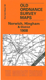
    This One Inch to the Mile map covers the central area of Norfolk, around and to the SW of Norwich. Coverage stretches from East Dereham eastward to Thorpe-next-Norwich, and from Ringland southward to Attleborough. Norwich is by far the largest place on the map, but other towns include Hingham, Wymondham, East Dereham (at the western edge) and Attleborough (at the southern edge.) Railways include the Wymondham & Wells Branch, the Midland & Great Northern Joint as it enters Norwich, and the Eastern Union line. As usual in Norfolk, there are dozens of small villages. On the back we include an extract from Norfolk Sheet 73.10, which shows the centre of Hingham in detail, complete with a good directory for the town.


    It is not possible to list the many hamlets, farmsteads and other topographical features shown on these maps. However, you might find it useful if we here list the majority of the principal villages and church parishes that are included on this map. Links are given for those for which detailed large-scale maps are also available.

  • Norfolk: Arminghall, Ashwellthorpe, Attleborough, Barford, Barnham Broom, Bawburgh, Besthorpe, Bixley, Bracon Ash, Brandon Parva, Caistor St Edmunds, Carleton Forehoe, Catton, Colton, Costessey, Coston, Cringleford, Crownthorpe, Deopham, Drayton, Dunston, East Carleton, East Dereham, East Tuddenham, Easton, Flordon, Framingham Pigot, Fundenhall, Garveston, Great Ellingham, Great Melton, Hackford, Hapton, Hardingham, Hellesdon, Hethel, Hethersett, Hingham, Hockering, Honingham, Howe, Intwood, Keswick, Ketteringham, Kimberley, Little Ellingham, Little Melton, Mattishall, Mattishall Burghs, Morley St Botolph, Morley St Peter, Mulbarton, Newton Flotman, North Tuddenham, Norwich, Reymerston, Ringland, Rockland St Peter, Saxlingham Nethergate, Saxlingham Thorpe, Scoulton, Shotesham All Saints, Shotesham St Mary, Southburgh, Sproweston, Stoke Holy Cross, Swainsthorpe, Swardeston, Tacolneston, Tasburgh, Taverham, Thorpe next Norwich, Thuxton, Welborne, Westfield, Whinbergh, Wicklewood, Woodrising, Wramplingham, Wreningham, Wymondham, Yaxham.

    For a full list of Inch to the Mile maps go to the One Inch Page, or for a full list of Norfolk maps go to Norfolk page. For other information and prices, and other areas, go to The Index Page.


    The Godfrey Edition / godfreyedition@btinternet.com / 28 December 2006