
 Here is information about Sheet 84:
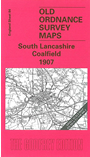
This Inch to the Mile map is an excellent accompaniment to the many more detailed, large scale maps we are publishing for the Wigan area. It covers the area from Kirkby and Ormskirk eastward to Leigh, and from Adlington and Horwich southward to St Helens. The area is criss-crossed by main-line and colliery railways. Other industries include locomotive building at Horwich and glass at St Helens, and there are several smaller towns, such as Earlestown, Newton in Makerfield, Hindley and Ormskirk, while many pit villages were becoming more urban. On the reverse we include a map of the village of Bryn, including part of Garswood Hall Collieries.
It is not possible to list the many hamlets, farmsteads and other topographical features shown on these maps. However, you may find it useful if we list the towns and principal villages or church parishes that are included on this map. Links are given for those for which detailed large-scale maps are also available.
Index maps are available showing the areas covered by the Inch to the Mile maps. Go to This page
You can order maps direct from our On-line Mapshop. For a full list of Inch to the Mile maps go to the Inch to the Mile page, where you will also find details of prices. For information on the rest of the series, go to The Index Page.