Old Ordnance Survey One-Inch Maps


These maps are taken from the famous OS "Inch to the Mile" Maps. Though obviously far less detailed than the large scale maps for which we are perhaps better known, they provide an invaluable overview of a wider area, typically 18 miles across by 12 miles down. For transport historians they are invaluable for showing old railways, while all historians need them for their close depiction of topography, including parish boundaries. These maps also mean that we can offer historical coverage for small villages where a large scale map would not be commercially viable. We intend to publish the whole of England and Wales in this series. Almost 200 titles are now available and we aim to publish three new titles each month. The maps include historical notes and all (except the double-sided Tyneside title) also include a large scale map of a small town or village in the area.

The maps are neatly folded and each includes a specially written introduction to the area. Maps can be purchased on our On-line Mapshop where further information about titles is given. Visit the One Inch Page for a full list of Inch to the Mile Maps, or The Index Page for a full list to the series and details of Prices.

Here is information about Sheet 73:

  • One Inch Sheet 73 North Holderness 1905 - published May 2003; introduction by David Neave

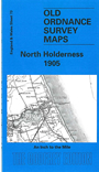
    This One Inch to the Mile map covers a coastal area of Yorkshire's East Riding, from Hornsea southward to Tunstall, westward to South Skirlaugh, part of the low-lying plain of Holderness. Small villages lie in this plain, while the long closed railway to Hornsea runs across the map. On the reverse we include a detailed map of the village of Aldbrough, together with a directory.


    It is not possible to list the many hamlets, farmsteads and other topographical features shown on these maps. However, you may find it useful if we list the towns and principal villages or church parishes that are included on this map. Links are given for those for which detailed large-scale maps are also available.

  • Yorkshire: Aldbrough, Bilton, Burton Constable, Catfoss, Coniston, East Newton, Ellerby, Elstronwick, Fitling, Flinton, Ganstead, Goxhill, Great Hatfield, Hilston, Hornsea, Humbleton, Lelley, Little Hatfield, Marton, Owstwick, Rise, Sigglesthorne, South Skirlaugh, Sproatley, Swine, Thirtleby, Tunstall, Withernwick, Wyton.

    For a full list of Inch to the Mile maps go to the One Inch Page; or for Yorkshire large scale maps go to the Yorkshire page.

    You can order maps direct from our On-line Mapshop. For other information and prices, and other areas, go to The Index Page.


    The Godfrey Edition / godfreyedition@btinternet.com / 3 December 2005