
 Here is information about Sheet 52:
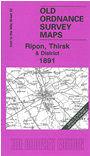
This One Inch to the Mile map covers an expanse of North Yorkshire that includes Ripon and Thirsk. Coverage stretches from West Tinfield eastward to Coxwold, and from North Otterington southward to Ripon. Features include several long closed railways, including those stretching northward from Ripon and the Thirsk Branch; Newburgh Park, Sutton Bank, and the lower reaches of the River Swale. On the reverse we include a detailed map of the village of Topcliffe.
It is not possible to list the many hamlets, farmsteads and other topographical features shown on these maps. However, you may find it useful if we list the towns and principal villages or church parishes that are included on this map. Links are given for those for which detailed large-scale maps are also available.
Index maps are available showing the areas covered by the Inch to the Mile maps. Go to This page
You can order maps direct from our On-line Mapshop. For a full list of Inch to the Mile maps go to the Inch to the Mile page, where you will also find details of prices. For information on the rest of the series, go to The Index Page.