We have published more than 2,000 maps in our series of Old Ordnance Survey Map reprints, including a group for the Yorkshire area. The maps are highly detailed. They are taken from the OS 1:2,500 (or 25 inch) maps and reduced to about 15 inches to the mile. Each covers an area of a mile and a half by a mile. They show streets with individual houses, tram tracks, railway tracks and even signals, factories, wharves and such details as fountains and water troughs. They will provide hours of fascination for historians and genealogists. The maps are neatly folded and each includes a specially written introduction to the area. Maps can be purchased on our On-line Mapshop where further information about titles is given. Or visit The Index Page for a full list to the series and details of Prices.
Here are the details of maps for Ripon:
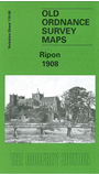
This highly detailed map of Ripon is double sided to give maximum coverage. The main map gives good coverage of the centre of this small cathedral city, with coverage extending westward to Bishopton, Bishopton Mills and Bishopton Close. Features include the Minster or Cathedral, Bondgate, Spa Gardens and Hydropathic Establishment, Borrage Green, Training College, Workhouse, Market Place. On the reverse we include part of adjacent sheet 119.07 extending coverage eastward to show the railway (but not station), Skellfield House, Fisher Green, canal, River Skell, St Mary Magdalen's chapel, River Ure, Sharow Cross.
And here is an index map showing the areas covered.
Follow this link for a complete list of our North Yorkshire maps or here for a complete list of Yorkshire titles.
You can order maps direct from our On-line Mapshop. For other information and prices, and other areas, go to The Index Page.
Maps in the Godfrey Edition are taken from the 25 inch to the mile map and reduced to about 15 inches to the mile. For a full list of maps for England, return to the England page.
The Godfrey Edition / godfreyedition@btinternet.com / 22 April 2007