Old Ordnance Survey One-Inch Maps


These maps are taken from the famous OS "Inch to the Mile" Maps. Though obviously far less detailed than the large scale maps for which we are perhaps better known, they provide an invaluable overview of a wider area, typically 18 miles across by 12 miles down. For transport historians they are invaluable for showing old railways, while all historians need them for their close depiction of topography, including parish boundaries. These maps also mean that we can offer historical coverage for small villages where a large scale map would not be commercially viable. We intend to publish the whole of England and Wales in this series. Almost 200 titles are now available and we aim to publish three new titles each month. The maps include historical notes and all (except the double-sided Tyneside title) also include a large scale map of a small town or village in the area.

The maps are neatly folded and each includes a specially written introduction to the area. Maps can be purchased on our On-line Mapshop where further information about titles is given. Visit the One Inch Page for a full list of Inch to the Mile Maps, or The Index Page for a full list to the series and details of Prices.

Here is information about Sheets 48:

  • One Inch Sheet 48 North Furness 1896 - published 2002; introduction by Alan Crosby

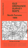
    This One Inch to the Mile map covers the area from Whitbeck, Silecroft and Millom eastward to Cartmel, and from Dalton in Furness and Baycliff northward to High Nibthwaite and the southern end of Coniston Water and Windermere. The Duddon Sands and Cartmel Sands intrude onto the landscape, while to the north are the Furness Fells, and to the NW Bootle Fell. On the reverse we include a detailed map of Cartmel, including the Priory Church, race course, and Town End; a directory for Cartmel is also included.


    It is not possible to list the many hamlets, farmsteads and other topographical features shown on these maps. However, you may find it useful if we list the towns and principal villages or church parishes that are included on this map. Links are given for those for which detailed large-scale maps are also available.

  • Cumberland: Millom, Whicham, Whitbeck.
  • Lancashire: Askam in Furness, Backbarrow, Broughton in Furness, Cartmel, Colton, Dalton in Furness, Great Urswick, Haverthwaite, Holker, Newby Bridge, Pennington, Ulverston.

    For a full list of Inch to the Mile maps go to the One Inch Page; or for other maps of the Furness area go to the Furness page.

    You can order maps direct from our On-line Mapshop. For other information and prices, and other areas, go to The Index Page.


    The Godfrey Edition / godfreyedition@btinternet.com / 5 December 2005