
 Here is information about Sheets 29:
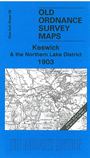
This early One Inch Ordnance Survey map covers the area around Keswick. Coverage stretches from Loweswater eastward to Ullswater, and from Blencathra southward to the Borrowdale Fells. Major features include Helvellyn, Derwent Water, Thirlmere, Crummock Water, Ennerdale Fell, Buttermere, Whin Fell, Lorton Fells, Derwent Fells, Wythburn Fells, Matterdale Common, Saddleback or Blencathra, Skiddaw. The Cockermouth Keswick & Penrith Railway crosses much of the map. On the reverse we include a detailed map of Buttermere village, with a contemporary directory.
It is not possible to list the many hamlets, farmsteads and other topographical features shown on these maps. However, you may find it useful if we list the towns and principal villages or church parishes that are included on this map. Links are given for those for which detailed large-scale maps are also available.
Index maps are available showing the areas covered by the Inch to the Mile maps. Go to This page
You can order maps direct from our On-line Mapshop. For a full list of Inch to the Mile maps go to the Inch to the Mile page, where you will also find details of prices. For information on the rest of the series, go to The Index Page.