Old Ordnance Survey One-Inch Maps


These maps are taken from the famous OS "Inch to the Mile" Maps. Though obviously far less detailed than the large scale maps for which we are perhaps better known, they provide an invaluable overview of a wider area, typically 18 miles across by 12 miles down. For transport historians they are invaluable for showing old railways, while all historians need them for their close depiction of topography, including parish boundaries. These maps also mean that we can offer historical coverage for small villages where a large scale map would not be commercially viable. We intend to publish the whole of England and Wales in this series. Over 250 titles are now available and we aim to publish three new titles each month. The maps include historical notes and all (except the double-sided Tyneside title) also include a large scale map of a small town or village in the area.

The maps are neatly folded and each includes a specially written introduction to the area. Maps can be purchased on our On-line Mapshop where further information about titles is given. Visit the One Inch Page for a full list of Inch to the Mile Maps, or The Index Page for a full list to the series and details of Prices.

Here is information about Sheet 18:

  • One Inch Sheet 18 Brampton & District 1903 - published 2008; introduction by Barrie Trinder

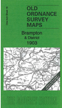
    This early One Inch Ordnance Survey map covers the area from the eastern suburbs of Carlisle eastward to Featherstone Castle and Blenkinsopp Hall. The only town is Brampton but other features include Naworth Park, much of the Alston Branch railway, several of Lord Carlisle's mineral lines, Geltsdale, Glendue Fell, Tindale Fells, stretches of Hadrian's Wall etc. On the reverse we include a detailed map of the village of Wetheral, including Wetheral Abbey, Corby Castle, Great Corby, station, Corby Gates, Holy Trinity church etc. Although most of the One Inch map is in Cumberland, a strip of Northumberland runs down the eastern side.

    It is not possible to list the many hamlets, farmsteads and other topographical features shown on these maps. However, you may find it useful if we list the towns and principal villages or church parishes that are included on this map. Links are given for those for which detailed large-scale maps are also available.

  • Cumberland: Brampton, Burtholme, Carlatton, Castle Carrock, Crosby upon Eden, Cumrew, Farlam, Gilsland, Hayton, Hethersgill, Irthington, Kirklinton Middle, Midgeholme, Naworth Park, Scaleby, Upper Denton, Walton, Warwick, Waterhead, Wetheral, Wreay.
  • Northumberland: Blenkinsopp, Featherstone, Greenhead, Kirkhaugh, Knarsdale, Lambley.

    Index maps are available showing the areas covered by the Inch to the Mile maps. Go to This page


    For a full list of maps for the county go to the Cumberland page; or to the Cumbria page for a full list for the region.

    You can order maps direct from our On-line Mapshop. For other information and prices, and other areas, go to The Index Page.


    The Godfrey Edition / godfreyedition@btinternet.com / 16 October 2008