
 Here are the details of maps for Kirkby in Ashfield:

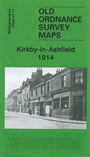
This very detailed map covers most of Kirkby in Ashfield, including East Kirkby, with coverage stretching from Church Street and St Wilfrid's church eastward to Diamond Avenue, East Kirkby; and from Oxford Street northward to Kirkby Colliery.
Features include Midland Railway with station and Kirkby Sidings, engine shed, GNR Leen Valley Extension railway, Kirkby Colliery, Market Hall, The Park area, hosiery factories, St Wilfrid's church, chapels and schools, St Thomas church etc. On the reverse we include a directory of Kirkby in 1891 plus a 1916 railway timetable for the Nottingham-Mansfield service.
The map links up with Notts sheets 27.07 Sutton in Ashfield (S) to the north.