Old Ordnance Survey Maps of Nottinghamshire

  • These detailed maps normally cover an area of about one and a half miles by one mile. Each map includes an introduction.
  • They are available through our On-line Mapshop

  • Here are the details of maps for Sutton in Ashfield:

  • Notts Sheet 27.03 Sutton-in-Ashfield 1914 - published 2009; intro by Barrie Trinder. ISBN.978-1-84784-320-3

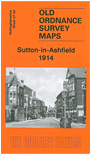
    This very detailed map covers the central, northern and eastern parts of Sutton in Ashfield, with coverage stretching from Albert Square northward to Forest Road and eastward to Coxmoor Road.

    Features include GNR railway with station, tramways, St Mary Magdalen church, Colliery Houses, Portland Square, New Cross area, Deepdale area, Skegby Forest, quarries, Sutton Forest Side area, The Old Mill, Dalestorth Brick Works, St Michael & All Angels church, Sutton Grange etc. On the reverse we include a directory of Sutton in Ashfield in 1891.

    The map links up with Notts sheets 27.07 Sutton in Ashfield (S) to the south.


  • Follow this link for a complete list of our Nottinghamshire Series maps.
  • You can order maps direct from our On-line Mapshop. For other information and prices, and other areas, go to The Index Page.
  • Maps in the Godfrey Edition are taken from the 25 inch to the mile map and reduced to about 15 inches to the mile. For a full list of maps for the East Midlands, return to the East Midlands page.
    The Godfrey Edition / sales@alangodfreymaps.co.uk / 29 December 2021