Old Ordnance Survey Maps of Nottinghamshire

  • These detailed maps normally cover an area of about one and a half miles by one mile. Each map includes an introduction.
  • They are available through our On-line Mapshop

  • Here are the details of maps for Mansfield (East):

  • Notts Sheet 23.13 Mansfield (East) 1914 - published 2002; intro by John Griffiths. ISBN.978-1-84151-390-4

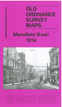
    This very detailed map covers the eastern part of Mansfield, with coverage stretching from West Gate and the Old Market Place eastward to the Old Race Course; and from Littleworth northward to Park Avenue.

    Features include Midland Railway with station, railway in course of construction, tramways, Market Place, Old Race Course, Grammar School, Town Hall, St Peter's church, schools, Rock Valley Mill, Bath Mill, Stanton Mill, The Park area, Hippodrome, Mansfield Brewery. On the reverse we include an 1891 commercial directory, entries N-Z.

    The map links up with Notts sheet 22.16 Mansfield West to the west and 23.09 Mansfield Woodhouse to the north.


  • Follow this link for a complete list of our Nottinghamshire Series maps.
  • You can order maps direct from our On-line Mapshop. For other information and prices, and other areas, go to The Index Page.
  • Maps in the Godfrey Edition are taken from the 25 inch to the mile map and reduced to about 15 inches to the mile. For a full list of maps for the East Midlands, return to the East Midlands page.
    The Godfrey Edition / sales@alangodfreymaps.co.uk / 22 October 2021