Old Ordnance Survey Maps of Nottinghamshire

  • These detailed maps normally cover an area of about one and a half miles by one mile. Each map includes an introduction.
  • They are available through our On-line Mapshop

  • Here are the details of maps for Mansfield (West):

  • Notts Sheet 22.16 Mansfield (West) 1914 - published 2002; intro by John Griffiths. ISBN.978-1-84151-389-8

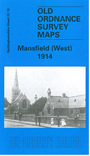
    This very detailed map covers the western part of Mansfield, with coverage stretching from West Street westward to Dalestorth Farm and Cock Lane, and from Princes Street northward to Mount Street.

    Features include Newtown Town area, trams and depot, Workhouse, Empire Theatre, Lawn Mills, St John's church, schools, Westfield House, Mansfield North Junction, etc. On the reverse we include an 1891 commercial directory, entries A-N.

    The map links up with Notts sheet 23.13 Mansfield East to the east.


  • Follow this link for a complete list of our Nottinghamshire Series maps.
  • You can order maps direct from our On-line Mapshop. For other information and prices, and other areas, go to The Index Page.
  • Maps in the Godfrey Edition are taken from the 25 inch to the mile map and reduced to about 15 inches to the mile. For a full list of maps for the East Midlands, return to the East Midlands page.
    The Godfrey Edition / sales@alangodfreymaps.co.uk / 28 January 2018