Old Ordnance Survey Maps of Nottinghamshire

  • These detailed maps normally cover an area of about one and a half miles by one mile. Each map includes an introduction.
  • They are available through our On-line Mapshop

  • Here are the details of maps for East Retford:

  • Notts Sheet 9.16 East Retford 1884 - published 2011; intro by Barrie Trinder. ISBN.978-1-84784-475-0

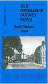
    This very detailed map covers East Retford with coverage extending from the Markeyt Square eastward to the edge of town.

    Features include MSL railway with station and engine shed, Market Square area, town centre with individual buildings neatly shown, St Swithin's church, South Retford area, part of Thrumpton, Wharncliffe House, Bee Hive Works, Chesterfield Canal, Balk Field, King Edward VI Grammar School, Workhouse, Spa Common etc. On the reverse we include an 1891 Retford directory, entries Mi-Z.

    The map links up with Notts sheet 09.15 West Retford to the west.


  • Follow this link for a complete list of our Nottinghamshire Series maps.
  • You can order maps direct from our On-line Mapshop. For other information and prices, and other areas, go to The Index Page.
  • Maps in the Godfrey Edition are taken from the 25 inch to the mile map and reduced to about 15 inches to the mile. For a full list of maps for the East Midlands, return to the East Midlands page.
    The Godfrey Edition / sales@alangodfreymaps.co.uk / 28 January 2018