Old Ordnance Survey Maps of Nottinghamshire

  • These detailed maps normally cover an area of about one and a half miles by one mile. Each map includes an introduction.
  • They are available through our On-line Mapshop

  • Here are the details of maps for West Retford:

  • Notts Sheet 9.15 West Retford & Babworth 1884 - published 2011; intro by Barrie Trinder. ISBN.978-1-84784-474-3

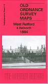
    This very detailed map covers West Retford and extends westward to Babworth Hall.

    Features include West Retford Hall, River Idle, St Michael's church, Holy Trinity Hospital, West Field area, GNR railway with station, engine shed, MSL railway with Whisker Hill Junction, East Retford Water Works, Biggins Farm, Ordsall House, Babworth Hall and Park, All Saints church, Babworth Farm. On the reverse we include an 1891 Retford directory, entries A-Me.

    The map links up with Notts sheet 09.16 East Retford to the east.


  • Follow this link for a complete list of our Nottinghamshire Series maps.
  • You can order maps direct from our On-line Mapshop. For other information and prices, and other areas, go to The Index Page.
  • Maps in the Godfrey Edition are taken from the 25 inch to the mile map and reduced to about 15 inches to the mile. For a full list of maps for the East Midlands, return to the East Midlands page.
    The Godfrey Edition / sales@alangodfreymaps.co.uk / 28 January 2018