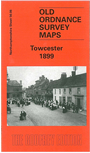
 Here are the details of maps for Towcester:

This detailed map of Towcester is double-sided to provide maximum coverage. The main map covers the town centre and the area westward to Costwell Farm and Green's Norton Hall. Features include Northampton & Banbury Jct Railway with station, Workhouse, St Lawrence's church, Hesketh Hotel, Watling Street, Grammar School, Town Hall, Bury Mount etc.
On the reverse we include part of adjacent sheet 56.07, which extends coverage eastward to include Brewery, rest of High Street, East Neston House, part of Easton Neston with St Mary's church. We also include a list of private residents from an 1898 directory.