Old Ordnance Survey Maps of Northamptonshire

  • These detailed maps normally cover an area of about one and a half miles by one mile. Each map includes an introduction.
  • They are available through our On-line Mapshop

  • Here are the details of maps for Rushden (West):

  • Northants Sheet 40.09 Rushden (West) 1923 - published 2005; intro by Barrie Trinder. ISBN.978-1-84151-752-0

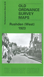
    This detailed map covers the western part of Rushden, with coverage stretching from the High Street westward to Knuston Hall.

    Features include railway station, Irchester Road area, boot & shoe factories, leather dressing works,High Street area, Church Green, Rushden Hall, Home Farm, Royal Theatre, etc. On the reverse we include a list of private residents from an 1898 directory, with the commercial entry, entries A-C.

    This map links up with Northants Sheet 40.10 Rushden (East) 1923


  • Follow this link for a complete list of our Northamptonshire maps.
  • You can order maps direct from our On-line Mapshop. For other information and prices, and other areas, go to The Index Page.
  • Maps in the Godfrey Edition are taken from the 25 inch to the mile map and reduced to about 15 inches to the mile. For a full list of maps for England, return to the England page.
    Alan Godfrey Maps, Prospect Business Park, Leadgate, Consett, Co Durham, DH8 7PW / sales@alangodfreymaps.co.uk / 5 January 2018