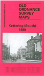
Northants Sheet 25.14 Kettering South 1899 - published 1998; intro by Barrie Trinder. ISBN.978-1-84151-017-0 
This detailed map covers the southern half of Kettering, with coverage stretching from Pridmore Square southward to
St Michael's Road.
Features include railway with station, engine shed, goods shed; St Peter & St Paul's church, Manor House, Town Hall, Royal Hotel, Almshouses, Nelson Shoe Works, Dalkeith Place area, Workhouse, Cattle Market, Cemetery, etc. On the reverse we include an 1898
commercial directory, entries K-Y.
This map links up with Northants Sheet 25.10 Kettering (North)
Follow this link for a complete list of our Northamptonshire maps.
You can order maps direct from our On-line Mapshop.
For other information and prices, and other areas, go to The Index Page.
Maps in the Godfrey Edition are taken from the 25 inch to the mile map and reduced to about 15 inches to the mile.
For a full list of maps for England, return to the England page.
Alan Godfrey Maps, Prospect Business Park, Leadgate, Consett, Co Durham, DH8 7PW / sales@alangodfreymaps.co.uk / 5 January 2018

 Here are the details of maps for Kettering (South):