
Old Ordnance Survey Maps of Northamptonshire
These detailed maps normally cover an area of about one and a half miles by one mile. Each map includes an introduction.
They are available through our On-line Mapshop
 Here are the details of maps for Corby:
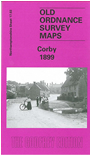
Northants Sheet 17.03 Corby 1899 - published 2001; intro by Barrie Trinder. ISBN.978-1-84151-317-1 
This detailed map shows what was then a village. Features include village centre with individual buildings shown, St Peter's church, Midland Railway,
Weldon & Corby station, ironstone quarries, with several mineral tramways, etc. On the reverse we include an 1898 commercial directory.
Follow this link for a complete list of our Northamptonshire maps.
You can order maps direct from our On-line Mapshop.
For other information and prices, and other areas, go to The Index Page.
Maps in the Godfrey Edition are taken from the 25 inch to the mile map and reduced to about 15 inches to the mile.
For a full list of maps for England, return to the England page.
Alan Godfrey Maps, Prospect Business Park, Leadgate, Consett, Co Durham, DH8 7PW / sales@alangodfreymaps.co.uk / 5 January 2018