
Old Ordnance Survey Maps of Hartlepool
These detailed maps normally cover an area of about one and a half miles by one mile. Each map includes an introduction.
They are available through our On-line Mapshop
 Here are the details of maps for Hartlepool:
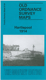
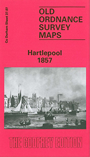
Co Durham Sheet 37.07 Hartlepool 1857 - published 1989; intro by Alan Godfrey. ISBN.978-0-85054-284-4  Co Durham Sheet 37.07 Hartlepool 1914 - published 1992; intro by Alan Godfrey. ISBN.978-0-85054-527-2
Two versions of this map are available, showing how the area developed across the years. Both maps are double-sided to provide maximum coverage.
They cover the Headland area of Hartlepool - the original town - and coverage extends westward to include Victoria Dock, the Old Harbour, Throston Ward and
Hartlepool Cemetery.
The early 1857 edition covers the original town around St Hilda's church, Market Place, High Street, railway terminus, Friarage Close, Farwell Field, Trinity church, Victoria Dock, Tide Harbour,
Hart Warren, Warren Cement Works, Milbank Forge, The Sleake, Warrenm Hall. West of the Tide Harbour there is little development, but Cleveland Road is shown built across an emnpty
landscape.
By contrast, the 1914 map - the year of Hartlepool's 'Bombardment' - is far more developed. The Headland area is again shown in full, but west of that around Victoria Dock and what is now called Old Harbour
are many railway and industrial developments including Fish Quay, Hartlepool Engine Works, station, engine sheds, Central Marine Engine Works, Central Shipbuilding Yard, Greenland Creosote Works, North Basin,
Cemetery Battery, Fort Sanitary Hospital.
We regret that the 1894 version of this map is currently unavailable.
The map links up with Sheet 37.11 West Hartlepool to the south
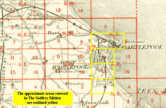
You might find this index map useful.
Follow this link for a complete list of our Hartlepool area maps.
You can order maps direct from our On-line Mapshop.
For other information and prices, and other areas, go to The Index Page.
Maps in the Godfrey Edition are taken from the 25 inch to the mile map and reduced to about 15 inches to the mile.
For a full list of maps for the North East, return to the North East page.
The Godfrey Edition / sales@alangodfreymaps.co.uk / 14 January 2018