Old Ordnance Survey Maps of Middlesex

  • These detailed maps maps normally cover an area of about one and a half miles by one mile. Each map includes an introduction. The Middlesex maps link up with those for London to form a major series for the Greater London area. They are available through our On-line Mapshop

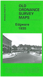
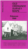
  • Here are the details of maps for Edgware:

  • Middlesex Sheet 6.13 a Edgware 1895 - published 1987; intro by Pamela Taylor. ISBN.978-0-85054-131-1
  • Middlesex Sheet 6.13 b Edgware 1935 - published 2009; intro by Pamela Taylor. ISBN.978-1-84784-285-5

    We have published two versions of this map, showing how the area developed across the years. The map covers the town centre, with coverage stretching from Canons and Canons Park eastward to Farm Road and Highview Gardens, and from Whitchurch Lane northward to Edgware Way. Features include St Margaret's church, GNR terminus, Bakerloo terminus, tramways, St Anthony's RC church, Stonegrove Park, The Basin, Canons, etc.

    The 1895 version shows Edgware when it was really a village and also includes a section of the 1911 revision on the reverse. The 1935 version includes a list private residents, entries A-G.

    The map links up with Middlesex Sheets 5.16 Great Stanmore to the west, 6.14 Mill Hill Broadway to the east, 11.01 Burnt Oak to the south.


  • Follow this link for a list of our maps for the London Borough of Barnet, or here for a complete list of our London maps .
  • You can order maps direct from our On-line Mapshop. For other information and prices, and other areas, go to The Index Page.
  • Maps in the Godfrey Edition are taken from the 25 inch to the mile map and reduced to about 15 inches to the mile. For a full list of maps for England, return to the England page.
    Alan Godfrey Maps, Prospect Business Park, Leadgate, Consett, Co Durham, DH8 7PW / sales@alangodfreymaps.co.uk / 15 January 2018