
Old Ordnance Survey Town Plans of Manchester
This group of maps is from the highly detailed 5 foot to the mile maps published by the Ordnance Survey in the
mid 19th century. We reduce them to a scale of a yard to the mile, making them more manageable in size while retaining the
detail. They even show the interiors of some buildings and, of course, are much earlier in date than most other OS large scale maps.
All maps are available from our On-line Mapshop.
Please bear in mind that because of the large scale they cover very small areas, approximately 1056 x 704 yards.
 These are the early Town Plans we publish for Manchester:
19 Miles Platting 1848 - published 2024; intro by Chris Makepeace
22 Salford Adelphi 1848 - published 1994; introduction by Nick Burton
23 Manchester Victoria 1849 - published 1987, 2nd edition 2024; intro by Alan Godfrey
24 Manchester (New Cross) 1849 - published 1988; intro by Chris Makepeace
25 Ancoats (North) 1848 - published 2012; intro by Chris Makepeace
27 New Bailey & Ordsall Lane 1849 - published 1988; intro Chris Makepeace
28 Manchester City Centre 1849 - published 1988; intro by Nick Burton
29 Manchester (Piccadilly) 1849 - published 1991; intro by Chris Makepeace
30 Ancoats 1849 - published 2011; intro by Chris Makepeace
32 Castlefield 1848 - published 1991; intro by Chris Makepeace
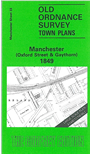
33 Manchester (Oxford St) 1849 - published 1988; intro by Nick Burton
34 Manchester (London Rd) 1849 - published 1988; intro by Chris Makepeace
35 Upper Ardwick 1849 - published 2000; intro by Chris Makepeace
37 Hulme: St Georges 1849 - published 1995; intro by Chris Makepeace
38 Hulme 1844 - published 1995; intro by Chris Makepeace
39 Chorlton on Medlock 1848 - published 1995; intro by Chris Makepeace
40 Higher Ardwick 1849 - published 2000; intro by Chris Makepeace
You might find this index grid useful.
 Most other maps in the Godfrey Edition are taken from the 25 inch to the mile map and reduced to about 15 inches to the mile.
For maps of Manchester at that scale go to the Manchester page. For a full list of Lancashire maps, return to the North West page
Most maps cost just £ 3.00 each. You can order them direct from our On-line Mapshop.
Most other maps in the Godfrey Edition are taken from the 25 inch to the mile map and reduced to about 15 inches to the mile.
For maps of Manchester at that scale go to the Manchester page. For a full list of Lancashire maps, return to the North West page
Most maps cost just £ 3.00 each. You can order them direct from our On-line Mapshop.
Alan Godfrey Maps, Prospect Business Park, Leadgate, Consett, DH8 7PW. Tel 01207 583388
The Godfrey Edition / sales@alangodfreymaps.co.uk / 16 October 2024