Old OS Town Plans of Manchester


  • For a few areas of Liverpool and Manchester we have also reprinted some of the very early Five-foot plans. Originally published at a scale of 1:1056 or 5 feet to the mile, we have reduced them in scale to 1:1760 or a Yard to the Mile. The maps, though covering quite a small area, are quite wonderfully detailed, showing such features as capstans and mooring posts, lamp-posts, the layouts of back yards, and even the interior of certain buildings such as churches. For the urban historian they are perhaps the most fascinating maps ever published by the Ordnance Survey.
  • Maps can be purchased on our On-line Mapshop.

  • Here are the details of maps for Salford Adelphi:

  • Manchester & Salford Sheet 22 Salford (Adelphi) 1848 - published 1994; intro by Nick Burton. ISBN.978-0-85054-682-8

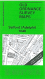
    This wonderfully detailed map covers the area of Salford around and to the north of the Town Hall, with coverage stretching from the River Irwell and Adelphi Street eastward to Fosey Street and Blossom Street; and from the Town Hall northward to Broughton Road. Much of the map is residential, with houses, courts and even outhouses neatly shown, but major features include Salford Gas Works, Broughton Road School, Chapel Street Chapel, St Stephen's church, St John's RC Chapel, Town Hall, St Matthias' church, Shaw's Brow, Bury Street Ropery, Salford Iron Works, St Philip's church, Adelphi Print Works, Adelphi Baths, Adelphi House, Broughton & Manchester Dyeing Works, Adelphi Sizing Works etc. We include street directory entries for Adelphi Place, Arlington Street, Great George Street, Peel Street, Peru Street and Saint Stephen Street on the reverse.

    The map links up with Manchester Sheets 23 Manchester Victoria to the east and 27 New Bailey to the south.


  • Follow this link for a complete list of our Manchester Town Plans or here for other maps of Manchester.
  • You can order maps direct from our On-line Mapshop. For other information and prices, and other areas, go to The Index Page.
  • Maps in the Godfrey Edition are taken from the 25 inch to the mile map and reduced to about 15 inches to the mile. For a full list of maps for Lancashire, return to the North West page.
    The Godfrey Edition / sales@alangodfreymaps.co.uk / 1 Feb 2018