
 Here are the details of maps for Ludlow:

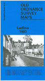
This detailed map of the historic town of Ludlow is double-sided to give maximum coverage. The main map covers the centre and north of the town, with coverage extending north to Fishmore and Sandpits, and eastward about a mile into open country and (in the NE corner) Rockgreen. Features include St Lawrence's church, St Stephen's church, Castle Street, Broad Street, Old Street, Corve Street, Lower Galdeford, cattle market, St Leonard's church, station with engine shed, workhouse, St John's church. On the reverse we extend coverage south and west to include the castle, Whitcliffe, Ludford Bridge, Ludford, Ludford Mill. A short extract from the directory of 1905 is also included, listing Private Residents.