We have published more than 2,000 maps in our series of Old Ordnance Survey Map reprints, with a highly successful series for London. Most maps are taken from the OS 1:2500 (or 25 inch) maps and reduced to about 15 inches to the mile. Each covers an area of a mile and a half by a mile. These show the areas in considerable detail, including individual houses.
For a few areas of central London we have also reprinted some of the very early Five-foot plans. Originally published at a scale of 1:1056 or 5 feet to the mile, we have reduced them in scale to 1:1760 or a Yard to the Mile (or 1:1836 or about 34 inches to the mile in the case of this map). The maps, though covering quite a small area, are quite wonderfully detailed, showing such features as lamp-posts, the layouts of back yards, and even the interior of certain buildings such as churches and theatres. For the urban historian they are perhaps the most fascinating maps ever published by the Ordnance Survey.
Our reprints are neatly folded and each includes a specially written introduction to the area. Maps can be purchased on our On-line Mapshop where further information about titles is given. Or visit The Index Page for a full list to the series and details of Prices.
Here are the details of maps for the St Marylebone area:
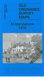
This very detailed map covers the area from Montagu Square eastward to Harley Street and from part of Marylebone Road southward to Manchester Square. A major feature is St Marylebone Workhosue, shown in detail. Other features include Hertford House (now the Wallace Collection), Portman Chapel, Baker Street Bazaar, Marylebone High Street. On the reverse we have street directories for Devonshire Street, Gloucester Place, Great Marylebone Street, High Street, Manchester Square, Montagu Place and Square, Paddington Street.
The map links up with Sheets 7.41 Baker St to the north, Paddington Green to the west, and 7.52 Langham Place to the east.
Follow this link for a complete list of our London Series maps. See Sheet 60 Paddington for a broad view of this area.
You can order maps direct from our On-line Mapshop. For other information and prices, and other areas, go to The Index Page.
Most maps in the Godfrey Edition are taken from the 25 inch to the mile map and reduced to about 15 inches to the mile. For a full list of maps for London, return to the London page.
The Godfrey Edition / godfreyedition@btinternet.com / 14 May 2007