Old Ordnance Survey Maps of Marylebone


We have published more than 2,000 maps in our series of Old Ordnance Survey Map reprints, with a highly successful series for London. Most maps are taken from the OS 1:2500 (or 25 inch) maps and reduced to about 15 inches to the mile. Each covers an area of a mile and a half by a mile. These show the areas in considerable detail, including individual houses.

For a few areas of central London we have also reprinted some of the very early Five-foot plans. Originally published at a scale of 1:1056 or 5 feet to the mile, we have reduced them in scale to 1:1760 or a Yard to the Mile. The maps, though covering quite a small area, are quite wonderfully detailed, showing such features as lamp-posts, the layouts of back yards, and even the interior of certain buildings such as churches and theatres. For the urban historian they are perhaps the most fascinating maps ever published by the Ordnance Survey.

Our reprints are neatly folded and each includes a specially written introduction to the area. Maps can be purchased on our On-line Mapshop where further information about titles is given. Or visit The Index Page for a full list to the series and details of Prices.


Here are the details of maps for St Marylebone & Baker Street:

  • London Large Scale Series Sheet 7.41 Upper Baker Street & Regents Park 1870 - published 2003. Introduction by Alan Godfrey

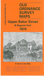
    This highly detailed map at a 'Yard to the Mile' scale covers the northern part of St Marylebone, including much of Regent's Park and the Royal Botanic Gardens. St Marylebone church is at the foot of the map. and other features include Baker Street station, Upper Baker Street, Outer Circle, Marlebone Road, Harley House, Toxophilite Society's Grounds, York Terrace. We include street directory entries for Upper Baker Street, Dorset Place, Dorset Square, Marylebone Road, Park Square, Park Street, Regent's Park and York Terrace in 1859 on the reverse. This map is essential viewing for the Sherlock Holmes enthusiast!

    The map links up with Sheets 7.42 Fitzroy Square to the east, 7.51 St Marylebone to the south.


    Follow this link for a complete list of our London Series maps.

    You can order maps direct from our On-line Mapshop. For other information and prices, and other areas, go to The Index Page.


    Most maps in the Godfrey Edition are taken from the 25 inch to the mile map and reduced to about 15 inches to the mile. For a full list of maps for London, return to the London page.

    The Godfrey Edition / godfreyedition@btinternet.com / 14 May 2007