We have published more than 2,000 maps in our series of Old Ordnance Survey Map reprints, with a highly successful series for London. Most maps are taken from the OS 1:2500 (or 25 inch) maps and reduced to about 15 inches to the mile. Each covers an area of a mile and a half by a mile. These show the areas in considerable detail, including individual houses.
For a few areas of central London we have also reprinted some of the very early Five-foot plans. Originally published at a scale of 1:1056 or 5 feet to the mile, we have reduced them in scale to 1:1760 or a Yard to the Mile (or 1:1836 or about 34 inches to the mile in the case of this map). The maps, though covering quite a small area, are quite wonderfully detailed, showing such features as lamp-posts, the layouts of back yards, and even the interior of certain buildings such as churches and theatres. For the urban historian they are perhaps the most fascinating maps ever published by the Ordnance Survey.
Our reprints are neatly folded and each includes a specially written introduction to the area. Maps can be purchased on our On-line Mapshop where further information about titles is given. Or visit The Index Page for a full list to the series and details of Prices.
Here are the details of maps for the Edgware Road area:
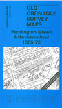
This very detailed map covers the area from Paddington Green and Paddington Basin eastward to Wyndham Place and the west side of Bryanston Square; and from Great James Street southward to Nutford Place. The Metropoliotan Railway's Edgware Road station, with engine sheds and carriage shop, is in the centre of the map. Other features include St Marylebone Public Baths, Paddington Chapel, Christ Church, St Luke's church, St Mary's church, Metropolitan Music Hall, Royal Cosmotheca Music Hall. The Edgware Road runs through the map. A selection of street directory entries is included on the back. (NB. Note that the map does not include Paddington station.)
This map links up with sheet 7.51 St Marylebone to the east.
Follow this link for a complete list of our London Series maps. See Sheet 60 Paddington for a broad view of this area.
You can order maps direct from our On-line Mapshop. For other information and prices, and other areas, go to The Index Page.
Most maps in the Godfrey Edition are taken from the 25 inch to the mile map and reduced to about 15 inches to the mile. For a full list of maps for London, return to the London page.
The Godfrey Edition / godfreyedition@btinternet.com / 1 May 2007