Old Ordnance Survey Maps of Uddingston


We have published more than 2,400 maps in our series of Old Ordnance Survey Map reprints; this includes more than 150 in Scotland, with a growing range of maps around Glasgow. The maps are highly detailed. They are taken from the OS 1:2,500 (or 25 inch) maps and reduced to about 15 inches to the mile. Each covers an area of a mile and a half by a mile. They show streets with individual houses, tram tracks, railway tracks and even signals, factories, wharves and such details as fountains and water troughs. They will provide hours of fascination for historians and genealogists. The maps are neatly folded and each includes a specially written introduction to the area. Maps can be purchased on our On-line Mapshop where further information about titles is given. Or visit The Index Page for a full list to the series and details of Prices.


Here are the details of maps for Uddingston:

  • Lanarkshire Sheet 11.07 Uddingston 1897 - published 2010; introduction by Gilbert Bell

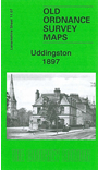
    This detailed map covers the small town of Uddingston, where features include Caledonian Railway with station (at top of map), NBR railway with station, Bothwell & Uddingston Gas Works, Douglas Gardens, town centre showing individual buildings neatly delineated, Bothwell Castle Home Farm, Gardenside area, Porters Well area, River Clyde. Coverage extends south to Bothwell Castle, remains of Blantyre Priory, Kirklands Lunatic Asylum, and westward to Blantyreferme House. On the reverse we include an 1892-3 directory of Uddingston.


    You might find this index map useful. The map links up with Sheets 11.01 Tannochside to the north, 11.06 Drumsagard to the west and 11.08 Bellshill to the east.


    Follow this link for a complete list of our Lanarkshire maps.

    You can order maps direct from our On-line Mapshop. For other information and prices, and other areas, go to The Index Page.


    Maps in the Godfrey Edition are taken from the 25 inch to the mile map and reduced to about 15 inches to the mile. For a full list of maps for Scotland, return to the Scotland page.

    The Godfrey Edition / godfreyedition@btinternet.com / 12 April 2010