Old Ordnance Survey Maps of Lanarkshire

  • These detailed maps normally cover an area of about one and a half miles by one mile. Each map includes an introduction.
  • They are available through our On-line Mapshop

  • Here are the details of maps for Bothwell:

  • Lanarkshire Sheet 11.11 Bothwell & Blantyre 1897 - published 2011; intro by Gilbert Bell. ISBN.978-1-84784-461-3

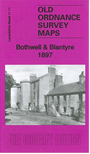
    This detailed map covers the town centre of Bothwell plus Blantyre on the other bank of the Clyde.

    Features include Blantyre Works, Low Blantyre, Bothwell Castle Colliery, southern part of Bothwell Castle, Caledonian Railway with Blantyre station, David Livingstone's Birthplace, Madder Mill, Powerloom Factory, Caledonian Bothwell Branch with terminus, NBR railway with Bothwell station, Craighead House, Silverwells area, church, Kirkfield area etc. On the reverse we include directories of Bothwell for 1892-93 and 1911-12.

    The map links up with Lanarkshire sheets 11.07 Uddingston to the north, 11.15 Stonefield to the south.


  • Follow this link for a complete list of our Glasgow or Lanarkshire maps.
  • You can order maps direct from our On-line Mapshop. For other information and prices, and other areas, go to The Index Page.
  • Maps in the Godfrey Edition are taken from the 25 inch to the mile map and reduced to about 15 inches to the mile. For a full list of maps for Scotland, return to the Scotland page.
    The Godfrey Edition / sales@alangodfreymaps.co.uk / 11 November 2016