Old Ordnance Survey Maps of Lanarkshire

  • These detailed maps normally cover an area of about one and a half miles by one mile. Each map includes an introduction.
  • They are available through our On-line Mapshop

  • Here are the details of maps for Drumsagard:

  • Lanarkshire Sheet 11.06 Drumsagard, Hallside & Newton 1896 - published 2010; intro by Gilbert Bell. ISBN.978-1-84784-366-1

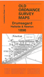
    This detailed map covers the area from Newton southward to Flemington and eastward to Blantyreferme House.

    Features include Hallside Steel Works, St Columba's church, Calderglen, Westburn Rows, Hallside Newhouse Farm, Newton Colliery Pits 1 and 2, Hallside Colliery, West and East Hallside, Blantyreferme Colliery, NBR railway with Newton station, stretch of CR Hamilton Branch, several mineral lines. On the reverse we include a directory of Cambusland entries E-Z.

    The map links up with Lanarkshire sheets 11.02 Broomhouse to the north, 11.05 Cambuslang to the west and 11.07 Uddingston to the east.


  • Follow this link for a complete list of our Glasgow or Lanarkshire maps.
  • You can order maps direct from our On-line Mapshop. For other information and prices, and other areas, go to The Index Page.
  • Maps in the Godfrey Edition are taken from the 25 inch to the mile map and reduced to about 15 inches to the mile. For a full list of maps for Scotland, return to the Scotland page.
    The Godfrey Edition / sales@alangodfreymaps.co.uk / 11 November 2016