Old Ordnance Survey Maps of Cambuslang


We have published more than 2,100 maps in our series of Old Ordnance Survey Map reprints; this includes more than 150 in Scotland, with a growing range of maps around Glasgow. The maps are highly detailed. They are taken from the OS 1:2,500 (or 25 inch) maps and reduced to about 15 inches to the mile. Each covers an area of a mile and a half by a mile. They show streets with individual houses, tram tracks, railway tracks and even signals, factories, wharves and such details as fountains and water troughs. They will provide hours of fascination for historians and genealogists. The maps are neatly folded and each includes a specially written introduction to the area. Maps can be purchased on our On-line Mapshop where further information about titles is given. Or visit The Index Page for a full list to the series and details of Prices.


Here are the details of maps for Cambuslang:

  • Lanarkshire Sheet 11.05 Cambuslang 1934 - published 2007; introduction by Gilbert Bell

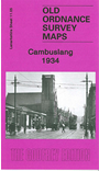
    This detailed map covers Cambuslang, just SE of Glasgow. Coverage extends from Wellshot Drive eastward to Lightburn Road, Springwell. The map covers the main centre of Cambuslang together with Halfway, Tanzieknowe, Howieshill, Kirkhill, Vicarland, Lightburn (bottom right corner) and Westburn (top right corner). Features include Gateside Colliery, Westburn Cemetery, Cambuslang Public Park, Westburn Farm, Westburn Steel Works (top margin), Rosebank Dye Works, Kirkhill station, tramway and several railways. We include a section of a 1911 directory, entries A-F, on the reverse.


    You might find this index map useful. The map links up with Sheet 11.01 Carmyle to the north.


    Follow this link for a complete list of our Lanarkshire maps.

    You can order maps direct from our On-line Mapshop. For other information and prices, and other areas, go to The Index Page.


    Maps in the Godfrey Edition are taken from the 25 inch to the mile map and reduced to about 15 inches to the mile. For a full list of maps for Scotland, return to the Scotland page.

    The Godfrey Edition / godfreyedition@btinternet.com / 29 February 2008